The channel sections
Published: 05 March 2024
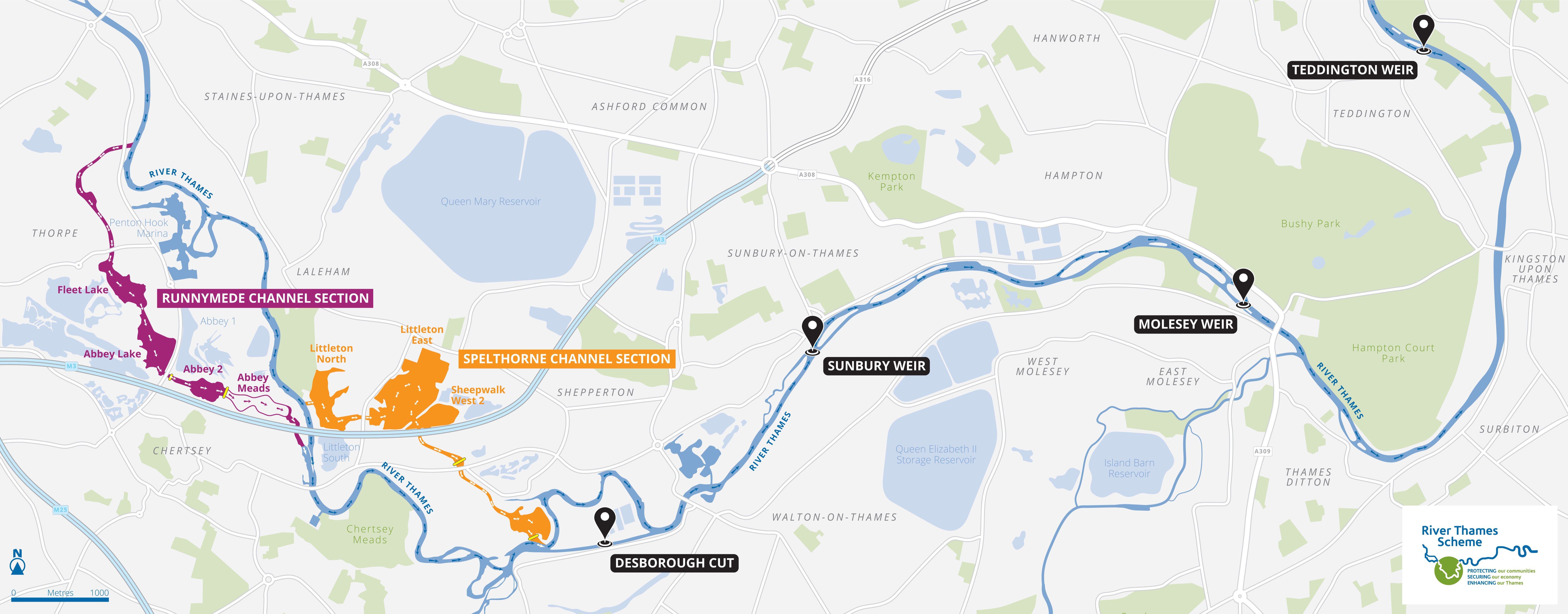
The River Thames Scheme will create a river channel in two sections. They are called Runnymede Channel Section and Spelthorne Channel Section. Together, they total over 5 miles (8.5km) long. Working together, the two sections will act as new flow routes for excess water when water levels in the River Thames rise too high.
The channels will flow through lakes, intersect existing watercourses such as streams, and cross under major roads. Additionally, improvements will be made to the weirs at Sunbury, Molesey, and Teddington. We'll also be lowering the riverbed downstream of Desborough Cut.
Map overview of the scheme
View full-size image (PDF)
Runnymede Channel Section
The Runnymede channel is nearly 3 miles (4.8 km) long and will run from Egham Hythe to Chertsey.
It starts just north of Ferry Avenue where it will cross under the A320 Chertsey Lane. From there, it heads south past Mead Lake and through Fleet Lake. It then joins with Abbey Lake before passing under the A320 Staines Road and joining Abbey 2 Lake.
It will cross new wetlands that will be created at Abbey Meads, before returning to the Thames along the route of the Burway Ditch which passes under the M3, downstream of Chertsey Weir.
Spelthorne Channel Section
The Spelthorne channel is almost 2 miles (3.2 km) long and runs from Laleham to Weybridge.
It starts between Laleham Sports Ground and the M3 at Thames Side where it enters Littleton North Lake. From there it heads east to join Littleton East Lake and Sheepwalk West 2 Lake before passing under the M3.
From there it flows south under Chertsey Road/Renfree Way before joining Ferris Meadow Lake. It then rejoins the Thames opposite D'Oyly Carte Island, upstream of Desborough Island and downstream of Shepperton Weir.
Document history
Published: 05 March 2024
Updated: 09 July 2025